Canterbury’s councils are making progress with the region’s climate plan, with new reports now available on two of its key actions.
The Canterbury Climate Partnership Plan (CCPP) was launched in 2024, and was developed by all 11 councils in the region to address climate change and build a sustainable, resilient, low-emissions future. It sets out 10 climate actions, with each council contributing to delivery and the shared work across Canterbury.
Action 2: Emissions reduction
Action 2 brings the region together to build equitable, inclusive pathways, targets and key actions that support New Zealand’s commitments to reducing global greenhouse gas emissions.
Following the Emissions Reduction Strategic Overview (9.8MB PDF), a range of possible initiatives were discussed with key stakeholders in late 2025. The Transition Risks and Opportunities Impact Assessment informed those sessions. It looks at the social, cultural, environmental, equity and economic impacts, both positive and negative, of the options under consideration, so people, businesses and communities can understand what each could mean for them.
The next step is the Waitaha Canterbury Transitions to Low Emissions Plan, expected to be finalised and published following the February 2027 Canterbury Mayoral Forum meeting.
Action 4: Nature-based solutions
Action 4 aims to develop a Canterbury blue-green network that increases natural capital and indigenous biodiversity, and offers nature-based solutions to climate change effects.
A new Canterbury-wide natural ecosystem climate change risk assessment (19MB PDF) has now been completed. The first of its kind in New Zealand, it mapped 765 indigenous ecosystems across land, freshwater and coastal environments, then assessed how exposed, sensitive and able to adapt each one is to future climate hazards. Of those, 26 were rated very high vulnerability and 76 high.
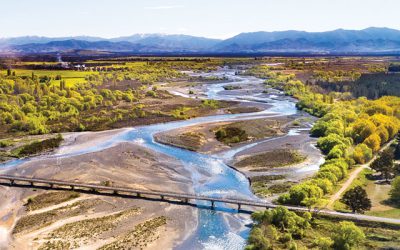
The assessment found (2MB PDF) coastal wetlands, braided river habitats, alpine ecosystems near the Main Divide and drylands in the Mackenzie country are among those expected to face growing pressure from hazards such as sea-level rise, flooding, heat, drought, wildfire and invasive plants. Kaikōura, the plains north of Christchurch and Mackenzie Country are likely to face a greater concentration of pressures.
The findings will help guide where protection and restoration efforts are most needed and provide evidence for the Waitaha Canterbury Blue-Green Network Plan. A Blue-Green Network Literature Review (7MB PDF) and regional inventory (4MB PDF) also supports that work.
The review is in the first stage of Action 4.2, led by Waimakariri District Council, and will inform the development of the Waitaha Canterbury Blue-Green Network Plan. Procurement for the plan is being finalised, with engagement hoped to begin early in 2027 and the final plan expected within 12 months.
Canterbury Mayoral Forum Chair Nigel Bowen said the report shows the value of a joined-up regional approach.
“Climate change doesn’t stop at the district boundaries, and neither does our response. These reports give our communities a clear picture of both the choices ahead and the places where our native habitats are most at risk, so we can focus our effort where it matters most.”
Canterbury Climate Champions Reference Group Chair Dan Gordon said the work is grounded in evidence.
“It is encouraging to see this work moving from planning into delivery. Understanding the risks and opportunities, for our people and our natural environment, puts Canterbury in a strong position to make good decisions.”
Read more about what else the Mayoral Forum has been working on.